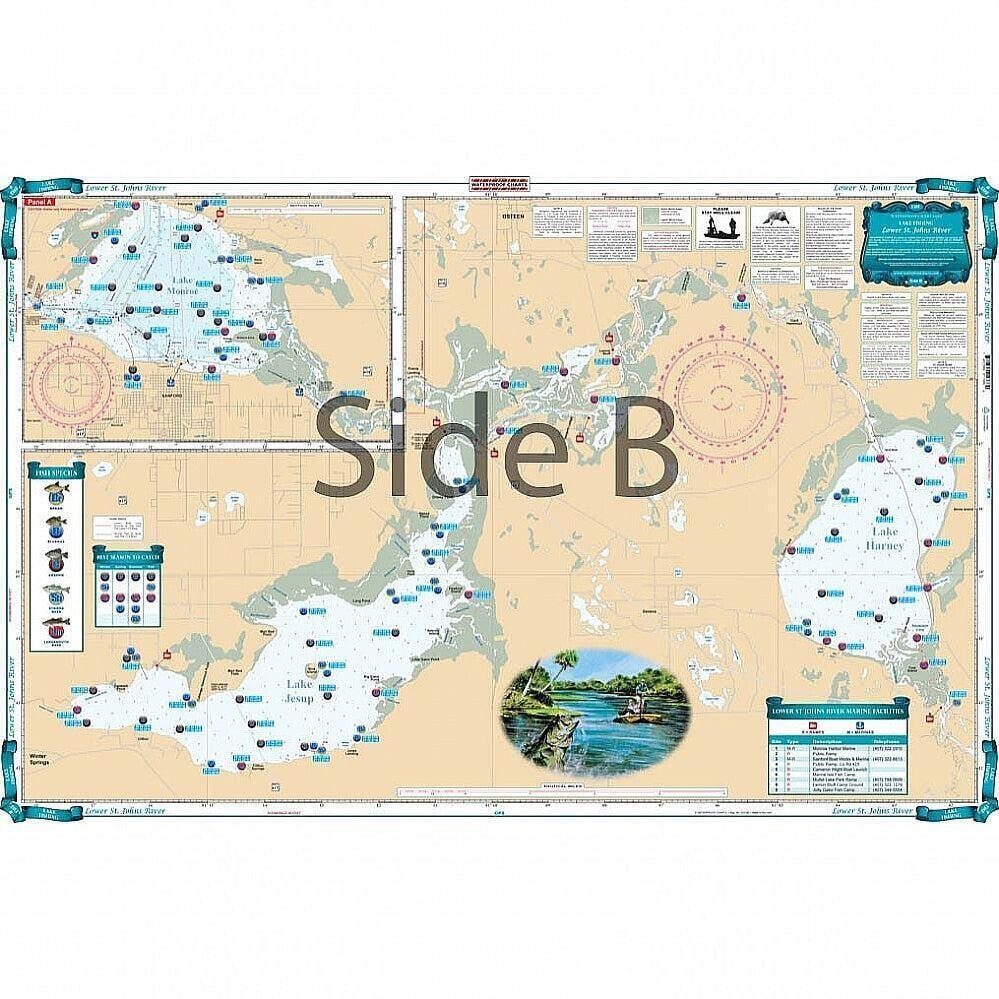
Waterproof Charts 138F Lower St. Johns River Fishing Lake
Bestseller
- Product Code:
- 131899534


121 GEL
Properties
- MPN
- 138F
- Unit Quantity
- 1
Features
- Gender
- Female, Male
Logistics data
- UPC
- 740399013860
Other features
- Brand
- Waterproof Charts
Weight & dimensions
- Weight
- 0.091 kg
Description
Waterproof Charts 138F Lower St. Johns River Fishing Lake Fishing
Covering the area from Lake Harney to the bottom of Lake George. This chart details all the major grass flats, marshes, and kayak trails. The chart pinpoints dozens of specific areas for the major species caught and best seasons to catch: Bluegill, Largemouth Bass, Channel Catfish, Crappie, Bream, and Striped Bass. There is a handy marine facilities guide included, with locations of different boat ramps, all shown on the chart. Grab this vibrantly colored St Johns River fishing chart and start catching more fish! This navigation map covers the area from Lake Harney to the bottom of Lake George. This marine map details all the major grass flats, marshes, and kayak trails. The chart pinpoints dozens of specific areas for the major species caught and best seasons to catch: Bluegill, Largemouth Bass, Channel Catfish, Crappie, Bream, and Striped Bass. There is a handy marine facilities guide included, with locations of different boat ramps, all shown on the navigation chart.